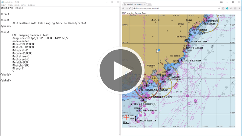
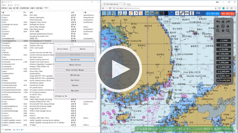
Hanulsoft's ENC image server is a product that can be operated in a web-based environment and generates electronic navigation chart images according to the desired latitude and longitude area and display options included in the request HTTP URL. It provides a very simple way of using only HTML IMG tags, and it is also very easy to use with open layers. It is automatically registered as a windows service at the time of software installation, and comes with administrator software to set the output format of the electronic navigation chart.
The ENC image server is suitable for environments where a lot of client terminals should be operated at low cost.
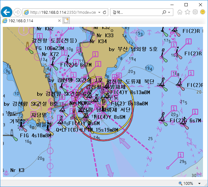
 Open Layers Interworking
In addition to the factors that can be identified through the first video when displaying the electronic navigation chart on your website using ENC image server, you can specify the expression of the electronic navigation chart more precisely by using various factors as shown in the table below. Please refer to the table below for the types, usage, and usage examples of each parameter that can be added to the URL.
| Parameter Name | Usage | Value | Etc |
|---|---|---|---|
| mode | Map creation mode | center or area | |
| lon | Center Longitude | -180 ~ 180 | mode is center |
| lat | Center Latitude | -85 ~ 85 | mode is center |
| left | Left Longitude | -180 ~ 180 | mode is area |
| bottom | Bottom Latitude | -85 ~ 85 | mode is area |
| right | Right Longitude | -180 ~ 180 | mode is area |
| top | Top Latitude | -85 ~ 85 | mode is area |
| dispcat | Display Category | 0, 1, 2 | |
| scale | Map Scale | float value | |
| rotation | Rotation Degree | 0 ~ 359 | |
| colorset | Color Set | 0, 1, 2, 3, 4, 5 | |
| width | Image Width | integer value | |
| height | Image Height | integer value | |
| lang | Language | 0 or 1 | |
| projection | WGS84/Mercator | W or M | |
| symbology | Symbology | T or S | |
| shallow | Shallow Pattern | 1 or 0 | |
| twoshade | Two Shade | 1 or 0 | |
| metaobj | Meta Object | 1 or 0 | |
| grid | Lat/Long Grid | 1 or 0 | |
| lightsector | Light Sectors | 1 or 0 | |
| lightdesc | Show Lights Description | 1 or 0 | |
| compass | Show Compass | 1 or 0 | |
| refdist | Show Reference Distance | 1 or 0 |
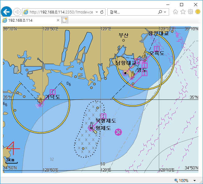
The mode determines how the map is generated.
If mode is center, you must specify both the center latitude and longitude and the scale.
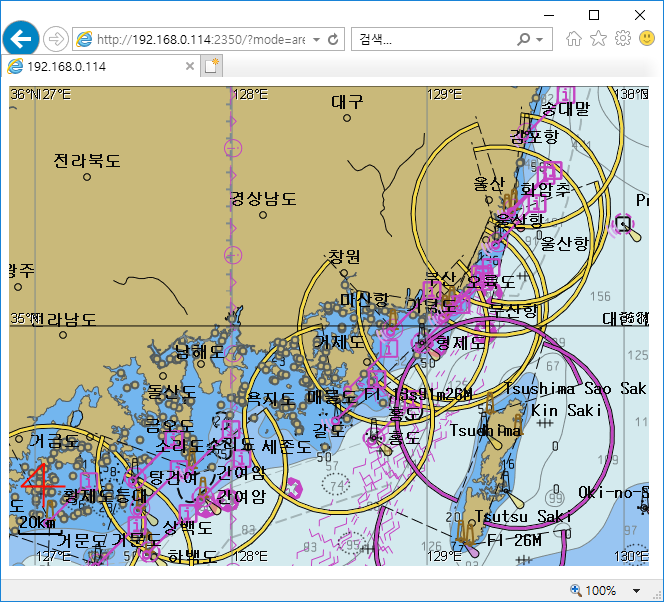
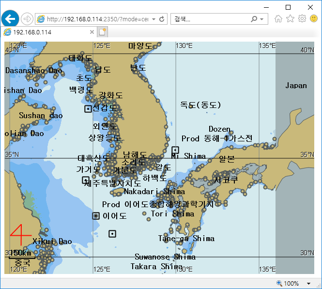
If mode is area, you must specify longitide(left, right) and latitude(top, bottom) values directly.
The width and height are the width and height of the map to be created. If mode is area, the aspect ratio of the area included in the latitude and longitude of the upper, lower, left, and right sides may not match the width-to-height ratio of the image. In such a case, change the latitude and longitude area inside the engine to the aspect ratio of the image.
Example when mode is center
http://192.168.0.114:2350/?mode=center&lon=129&lat=35&width=640&height=480&scale=300000
Example when mode is area
http://192.168.0.114:2350/?mode=area&left=128&bottom=34&right=129&top=36&width=640&height=480
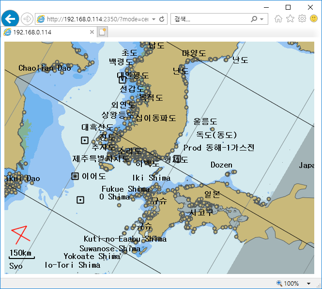
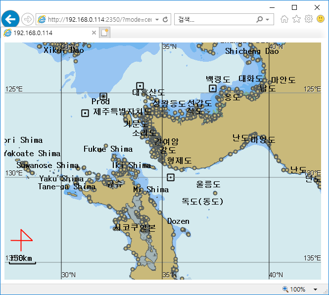
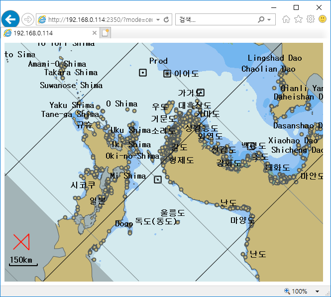
The rotation specifies the degree of turn of the map in degrees(°, degrees) in the clockwise direction.
If a grid of latitude and longitude is being displayed, the latitude and longitude values are displayed only for 0, 90, 180, and 270.
Example when rotation is 0°
http://192.168.0.114:2350/?mode=center&lon=129.014695&lat=35.048158&width=640&height=480&scale=10000000&dispcat=0&rotation=0
Example when rotation is 30°
http://192.168.0.114:2350/?mode=center&lon=129.014695&lat=35.048158&width=640&height=480&scale=10000000&dispcat=0&rotation=30
Example when rotation is 90°
http://192.168.0.114:2350/?mode=center&lon=129.014695&lat=35.048158&width=640&height=480&scale=10000000&dispcat=0&rotation=90
Example when rotation is 135°
http://192.168.0.114:2350/?mode=center&lon=129.014695&lat=35.048158&width=640&height=480&scale=10000000&dispcat=0&rotation=135
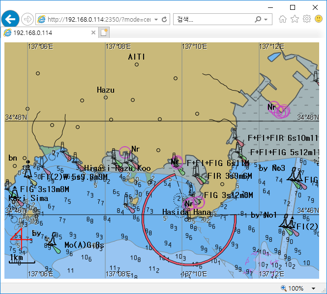
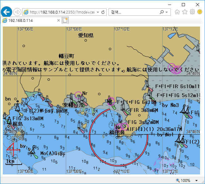
The language specifies the display character of the electronic navigation chart text.
If the value is 0, it is displayed in English characters. If it is 1, it is displayed in the characters of the country where the electronic navigation chart is made.
A Example when lang is 0 (Korea)
http://192.168.0.114:2350/?mode=center&lon=129.014695&lat=35.048158&width=640&height=480&scale=30000&dispcat=0&lang=0
文 Example when lang is 1 (Korea)
http://192.168.0.114:2350/?mode=center&lon=129.014695&lat=35.048158&width=640&height=480&scale=30000&dispcat=0&lang=1

A Example when lang is 0 (Japan)
http://192.168.0.114:2350/?mode=center&lon=137.158&lat=34.786&width=640&height=480&scale=73160&dispcat=2&lang=0
文 Example when lang is 1 (Korea)
http://192.168.0.114:2350/?mode=center&lon=137.158&lat=34.786&width=640&height=480&scale=73160&dispcat=2&lang=1
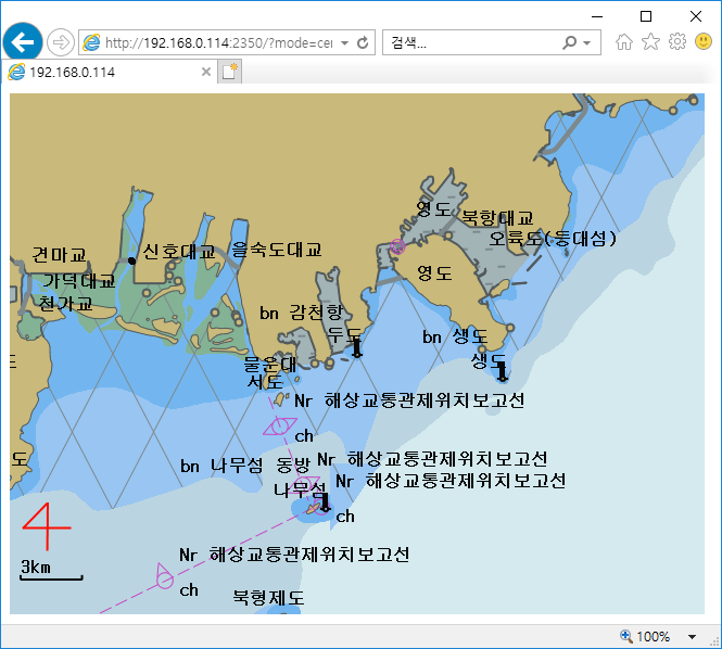
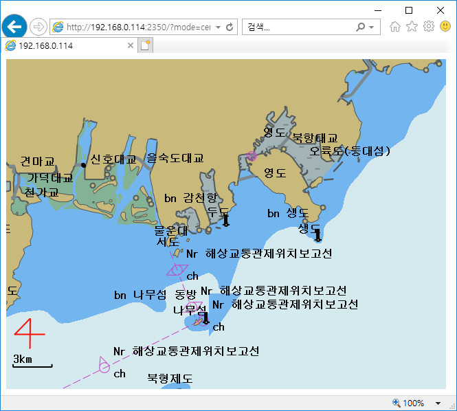
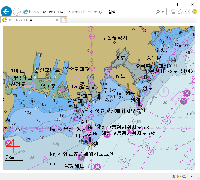
The dispcat specifies the degree of detail display of the electronic chart.
You can specify one of 0, 1, or 2, and the larger the value, the more detail is displayed.
If you do not specify a value, the image is created using the values set by the administrator.
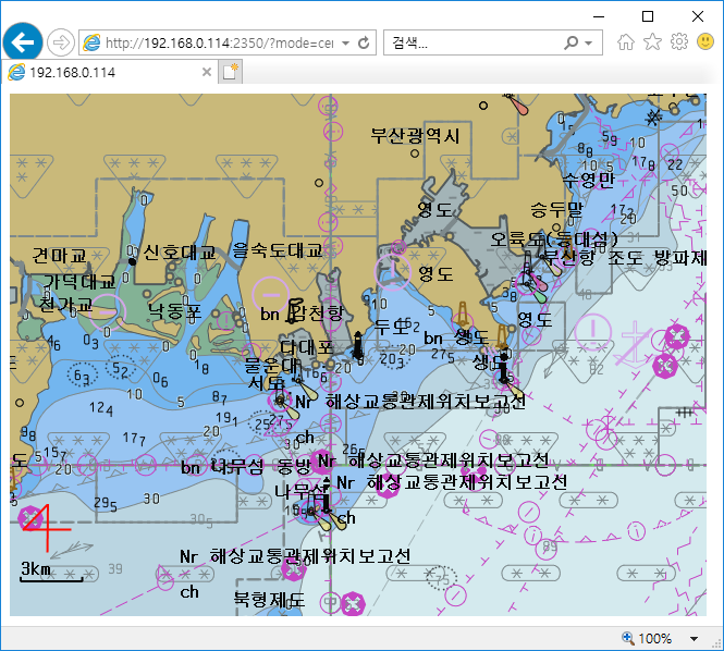
The colorset specifies the color of the electronic navigation chart.
You can specify one of 0, 1, 2, 3, 4, or 5 as a color set. 0 ~ 4 has a color scheme according to the S-52 standard color, and 5 is the color specified by the user. User colors can be set through user colors in the administrator program.
If you do not specify a value, use the value 0 to create the image.
Example when dispcat is 0
http://192.168.0.114:2350/?mode=center&lon=129.014695&lat=35.048158&width=640&height=480&scale=30000&dispcat=0
Example when dispcat is 1
http://192.168.0.114:2350/?mode=center&lon=129.014695&lat=35.048158&width=640&height=480&scale=30000&dispcat=1
Example when dispcat is 2
http://192.168.0.114:2350/?mode=center&lon=129.014695&lat=35.048158&width=640&height=480&scale=30000&dispcat=2
Example when colorset is 0
http://192.168.0.114:2350/?mode=center&lon=129.014695&lat=35.048158&width=640&height=480&scale=30000&dispcat=0&colorset=0

Example when colorset is 1
http://192.168.0.114:2350/?mode=center&lon=129.014695&lat=35.048158&width=640&height=480&scale=30000&dispcat=0&colorset=0
Example when colorset is 2
http://192.168.0.114:2350/?mode=center&lon=129.014695&lat=35.048158&width=640&height=480&scale=30000&dispcat=0&colorset=0
Example when colorset is 3
http://192.168.0.114:2350/?mode=center&lon=129.014695&lat=35.048158&width=640&height=480&scale=30000&dispcat=0&colorset=0
Example when colorset is 4
http://192.168.0.114:2350/?mode=center&lon=129.014695&lat=35.048158&width=640&height=480&scale=30000&dispcat=0&colorset=0
Example when colorset is 5
http://192.168.0.114:2350/?mode=center&lon=129.014695&lat=35.048158&width=640&height=480&scale=30000&dispcat=0&colorset=0
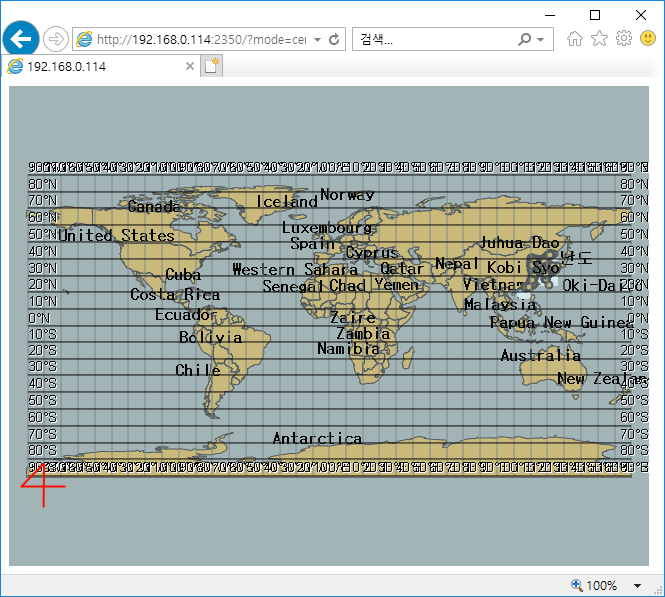
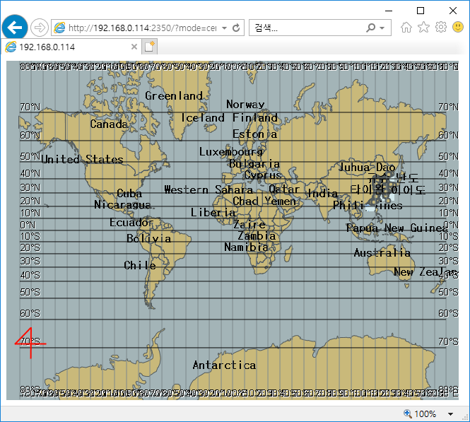
The projection specifies the projection method of the map. Hanulsoft's ENC kernel supports both WGS-84 and Mercator projection.
If the projection value is W, the map is displayed using WGS-84 projection. If the projection value is M, the map is displayed using Mercator projection.
Example when projection is W
http://192.168.0.114:2350/?mode=center&lon=0&lat=0&width=640&height=480&scale=250000000&dispcat=0&lang=1&projection=W
Example when projection is M
http://192.168.0.114:2350/?mode=center&lon=0&lat=0&width=640&height=480&scale=250000000&dispcat=0&lang=1&projection=M
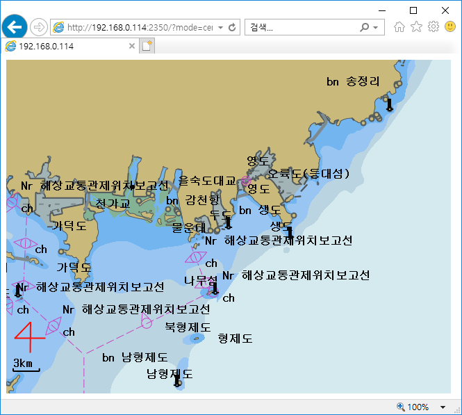
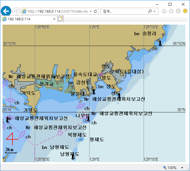
The grid sets whether or not to display a grid indicating latitude and longitude.
If the grid value is 0, the grid is not displayed. If the grid value is 1, the grid is displayed.
The spacing of the grid is automatically determined by the scale.
Example when grid is 0
http://192.168.0.114:2350/?mode=center&lon=129.014695&lat=35.048158&width=640&height=480&scale=300000&dispcat=0&grid=0
Example when grid is 1
http://192.168.0.114:2350/?mode=center&lon=129.014695&lat=35.048158&width=640&height=480&scale=300000&dispcat=0&grid=1
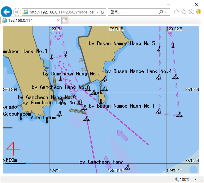
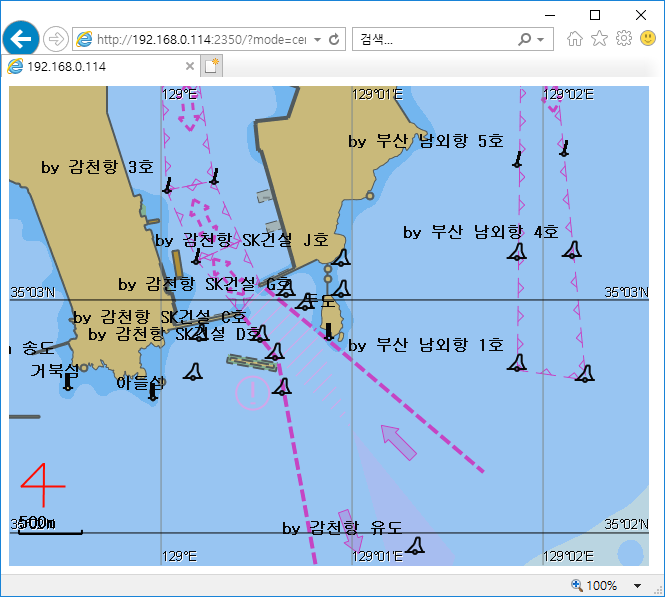
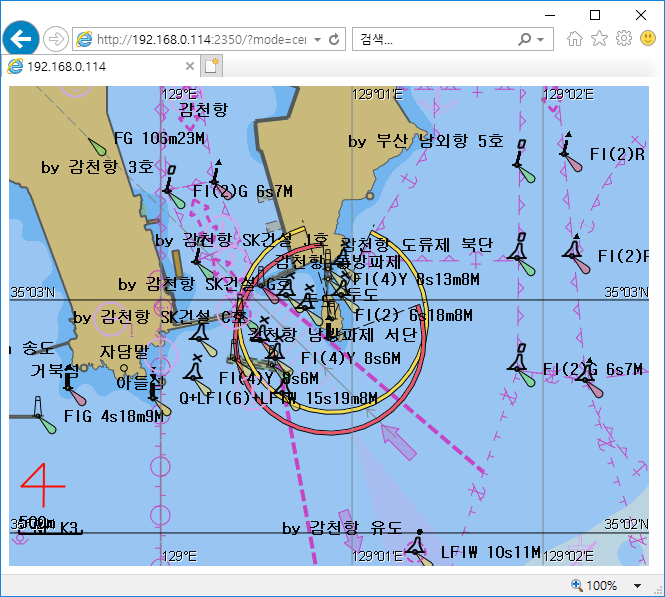
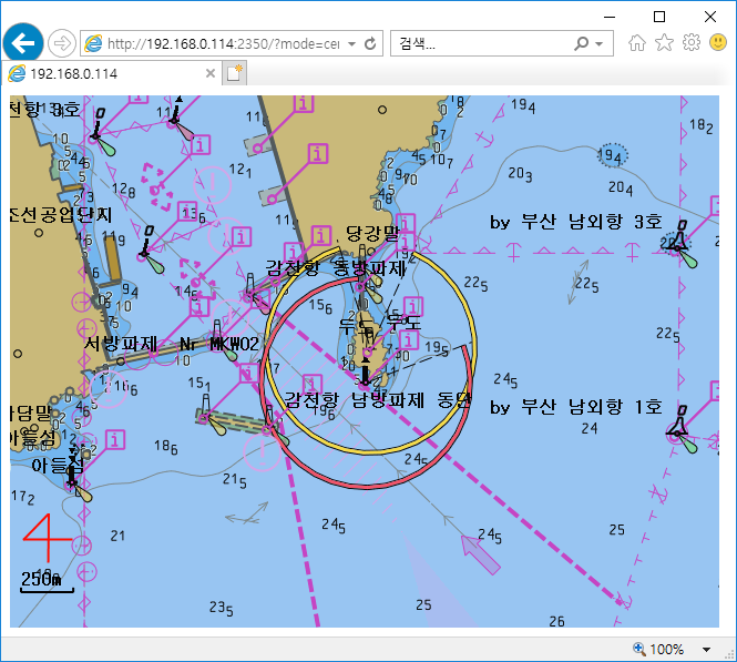
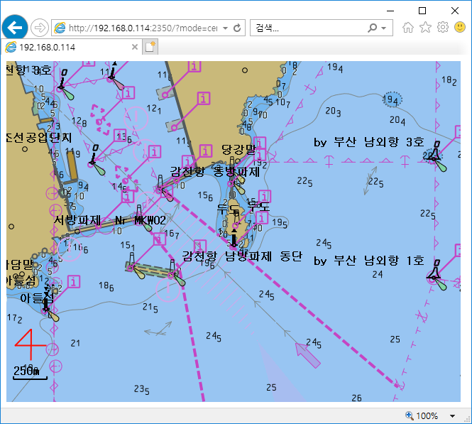
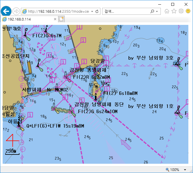
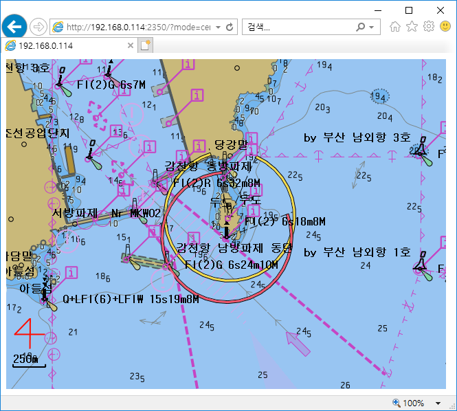
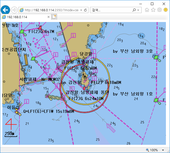
The lightsector sets whether to display the direction angle of the lighthouse.
The lightdesc sets whether or not to display descriptive text for the lighthouse.
Example when lightsector is 1 and lightdesc is 1
http://192.168.0.114:2350/?mode=center&lon=129.014695&lat=35.048158&width=640&height=480&scale=20000&dispcat=2&grid=0&lightsector=1&lightdesc=1

Example when lightsector is 1 and lightdesc is 0
http://192.168.0.114:2350/?mode=center&lon=129.014695&lat=35.048158&width=640&height=480&scale=20000&dispcat=2&grid=0&lightsector=1&lightdesc=0
Example when lightsector is 0 and lightdesc is 0
http://192.168.0.114:2350/?mode=center&lon=129.014695&lat=35.048158&width=640&height=480&scale=20000&dispcat=2&grid=0&lightsector=0&lightdesc=0
Example when lightsector is 0 and lightdesc is 1
http://192.168.0.114:2350/?mode=center&lon=129.014695&lat=35.048158&width=640&height=480&scale=20000&dispcat=2&grid=0&lightsector=0&lightdesc=1
The symbology has a T or S value that specifies how to display the symbols displayed on the map.
When the symbology value is T, symbols are drawn in a conventional way. When the symbology value is S, symbols are drawn in a concise way.
Example when symbology value is T
http://192.168.0.114:2350/?mode=center&lon=129.014695&lat=35.048158&width=640&height=480&scale=20000&dispcat=2&grid=0&symbology=T
Example when symbology value is S
http://192.168.0.114:2350/?mode=center&lon=129.014695&lat=35.048158&width=640&height=480&scale=20000&dispcat=2&grid=0&symbology=S
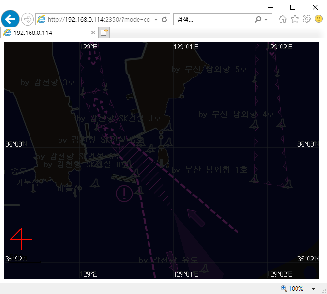
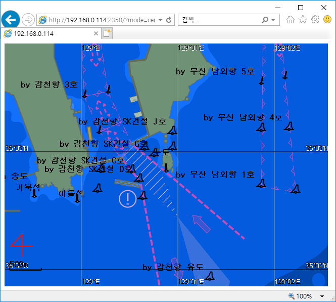
The shallow specifies whether to display the pattern for shallow depth.
When the shallow value is 1, as shown in the example below, an X-shaped pattern appears in the background in a shallow depth region.
Example of when the shallow value is 0
http://192.168.0.114:2350/?mode=center&lon=129.014695&lat=35.048158&width=640&height=480&scale=200000&dispcat=0&grid=0&shallow=0
Example of when the shallow value is 1
http://192.168.0.114:2350/?mode=center&lon=129.014695&lat=35.048158&width=640&height=480&scale=200000&dispcat=0&grid=0&shallow=1
To display colors by depth, twoshade sets whether to use 2 colors or 4 colors.
Example when twoshade value is 0
http://192.168.0.114:2350/?mode=center&lon=129.014695&lat=35.048158&width=640&height=480&scale=200000&dispcat=0&grid=0&twoshade=0

Example when twoshade value is 1
http://192.168.0.114:2350/?mode=center&lon=129.014695&lat=35.048158&width=640&height=480&scale=200000&dispcat=0&grid=0&twoshade=1
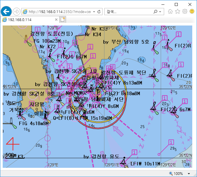
metaobj specifies whether to display ENC Meta Objects on the screen.
Example when metaobj value is 0
http://192.168.0.114:2350/?mode=center&lon=129.014695&lat=35.048158&width=640&height=480&scale=200000&dispcat=2&grid=0&informsymbol=0&lightsector=0&lightdesc=0&metaobj=0
Example when metaobj value is 1
http://192.168.0.114:2350/?mode=center&lon=129.014695&lat=35.048158&width=640&height=480&scale=200000&dispcat=2&grid=0&informsymbol=0&lightsector=0&lightdesc=0&metaobj=1
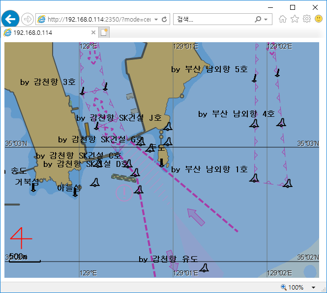
The compass determines whether the current azimuth is displayed in the lower left corner of the screen in the form of a four-figure figure.
The refdist determines whether the base distance is displayed at the bottom left of the screen in proportion to the scale.
Example when compass and refdist are 0
http://192.168.0.114:2350/?mode=center&lon=129.014695&lat=35.048158&width=640&height=480&scale=200000&dispcat=2&grid=0&informsymbol=0&lightsector=0&lightdesc=0&metaobj=0
Example when compass and refdist are 1
http://192.168.0.114:2350/?mode=center&lon=129.014695&lat=35.048158&width=640&height=480&scale=200000&dispcat=2&grid=0&informsymbol=0&lightsector=0&lightdesc=0&metaobj=1