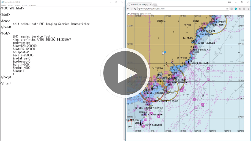
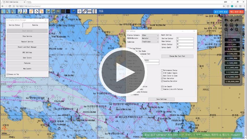
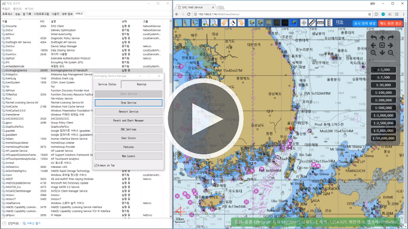
mode는 맵을 생성하는 방식을 결정합니다.
mode가 center일 때는 중심 위경도와 축적(scale)을 함께 지정해 주어야 합니다.
mode가 area일 때는 좌우(left, right) 경도값과 상하(top, bottom) 위도값을 직접 지정하여야 합니다.
width와 height는 생성할 맵의 가로/세로 크기를 가리킵니다. mode가 area일 때 상하좌우 위경도에 포함되는 영역의 종횡비가
이미지의 가로세로비가 일치하지 않을 수 있는데 그런 경우에는 엔진 내부에서 위경도 영역을 영상의 종횡비에 맞추어 변경합니다.
http://192.168.0.114:2350/?mode=center&lon=129&lat=35&width=640&height=480&scale=300000
http://192.168.0.114:2350/?mode=area&left=128&bottom=34&right=129&top=36&width=640&height=480
rotation은 맵의 회전 정도를 시계 방향의 도(°, degree) 단위로 지정합니다.
위경도 격자가 표시되고 있을 경우 위경도 값은 0, 90, 180, 270인 경우에만 표시됩니다.
http://192.168.0.114:2350/?mode=center&lon=129.014695&lat=35.048158&width=640&height=480&scale=10000000&dispcat=0&rotation=0
http://192.168.0.114:2350/?mode=center&lon=129.014695&lat=35.048158&width=640&height=480&scale=10000000&dispcat=0&rotation=30
http://192.168.0.114:2350/?mode=center&lon=129.014695&lat=35.048158&width=640&height=480&scale=10000000&dispcat=0&rotation=90
http://192.168.0.114:2350/?mode=center&lon=129.014695&lat=35.048158&width=640&height=480&scale=10000000&dispcat=0&rotation=135
lang(Language)은 전자해도 텍스트의 표시 문자를 지정합니다.
0인 경우 영문자로 표시되고 1인 경우 전자해도를 제작한 국가의 문자로 표시됩니다.
A
lang이 0인 예 (한국)
http://192.168.0.114:2350/?mode=center&lon=129.014695&lat=35.048158&width=640&height=480&scale=30000&dispcat=0&lang=0
文
lang이 1인 예 (한국)
http://192.168.0.114:2350/?mode=center&lon=129.014695&lat=35.048158&width=640&height=480&scale=30000&dispcat=0&lang=1
A
lang이 0인 예 (일본)
http://192.168.0.114:2350/?mode=center&lon=137.158&lat=34.786&width=640&height=480&scale=73160&dispcat=2&lang=0
文
lang이 1인 예 (일본)
http://192.168.0.114:2350/?mode=center&lon=137.158&lat=34.786&width=640&height=480&scale=73160&dispcat=2&lang=1
dispcat은 전자해도 표시의 상세도를 지정합니다.
0, 1, 2 중의 한 값을 지정할 수 있으며 값이 클 수록 상세하게 표시됩니다.
값을 지정하지 않을 경우 관리자에서 설정한 값을 사용하여 이미지를 생성합니다.
colorset은 전자해도의 색상을 지정합니다.
0, 1, 2, 3, 4, 5 중의 한 값을 지정할 수 있습니다. 0~4는 S-52 표준 색상에 따른 색상 구성을 가지며
5는 사용자가 지정한 색상입니다. 사용자 색상은 관리자 프로그램의 User Colors를 통해 설정할 수 있습니다.
값을 지정하지 않을 경우 0값을 사용하여 이미지를 생성합니다.
http://192.168.0.114:2350/?mode=center&lon=129.014695&lat=35.048158&width=640&height=480&scale=30000&dispcat=0
http://192.168.0.114:2350/?mode=center&lon=129.014695&lat=35.048158&width=640&height=480&scale=30000&dispcat=1
http://192.168.0.114:2350/?mode=center&lon=129.014695&lat=35.048158&width=640&height=480&scale=30000&dispcat=2
http://192.168.0.114:2350/?mode=center&lon=129.014695&lat=35.048158&width=640&height=480&scale=30000&dispcat=0&colorset=0
http://192.168.0.114:2350/?mode=center&lon=129.014695&lat=35.048158&width=640&height=480&scale=30000&dispcat=0&colorset=0
http://192.168.0.114:2350/?mode=center&lon=129.014695&lat=35.048158&width=640&height=480&scale=30000&dispcat=0&colorset=0
http://192.168.0.114:2350/?mode=center&lon=129.014695&lat=35.048158&width=640&height=480&scale=30000&dispcat=0&colorset=0
http://192.168.0.114:2350/?mode=center&lon=129.014695&lat=35.048158&width=640&height=480&scale=30000&dispcat=0&colorset=0
http://192.168.0.114:2350/?mode=center&lon=129.014695&lat=35.048158&width=640&height=480&scale=30000&dispcat=0&colorset=0
projection은 지도의 투영법을 지정합니다. 하늘소프트의 전자해도 커널에서는 현재 WGS-84와 메르카토르 투영법 두 가지를 지원하고 있습니다.
projection 값이 W인 경우 WGS-84 투영법을 사용하고, projection 값이 M인 경우 메르카토르 투영법을 사용하여 지도를 표시합니다.
http://192.168.0.114:2350/?mode=center&lon=0&lat=0&width=640&height=480&scale=250000000&dispcat=0&lang=1&projection=W
http://192.168.0.114:2350/?mode=center&lon=0&lat=0&width=640&height=480&scale=250000000&dispcat=0&lang=1&projection=M
grid는 위경도를 가리키는 격자의 표시 여부를 설정합니다.
grid 값이 0이면 격자를 표시하지 않고, grid 값이 1이면 격자를 표시합니다.
격자의 간격은 축적에 따라 자동으로 결정됩니다.
http://192.168.0.114:2350/?mode=center&lon=129.014695&lat=35.048158&width=640&height=480&scale=300000&dispcat=0&grid=0
http://192.168.0.114:2350/?mode=center&lon=129.014695&lat=35.048158&width=640&height=480&scale=300000&dispcat=0&grid=1
lightsector는 등대의 조사 방향각의 표시 여부를 설정합니다.
lightdesc는 등대에 대한 설명 텍스트의 표시 여부를 설정합니다.
http://192.168.0.114:2350/?mode=center&lon=129.014695&lat=35.048158&width=640&height=480&scale=20000&dispcat=2&grid=0&lightsector=1&lightdesc=1
http://192.168.0.114:2350/?mode=center&lon=129.014695&lat=35.048158&width=640&height=480&scale=20000&dispcat=2&grid=0&lightsector=1&lightdesc=0
http://192.168.0.114:2350/?mode=center&lon=129.014695&lat=35.048158&width=640&height=480&scale=20000&dispcat=2&grid=0&lightsector=0&lightdesc=0
http://192.168.0.114:2350/?mode=center&lon=129.014695&lat=35.048158&width=640&height=480&scale=20000&dispcat=2&grid=0&lightsector=0&lightdesc=1
symbology는 지도 상에 표시되는 심볼을 전시하는 방식을 지정하는 인자로 T 또는 S 값을 가집니다.
symbology 값이 T일 때는 전통적인 방식으로 심볼들이 그려지며, symbology 값이 S일 때는 간결한 방식으로 심볼들이 그려집니다.
http://192.168.0.114:2350/?mode=center&lon=129.014695&lat=35.048158&width=640&height=480&scale=20000&dispcat=2&grid=0&symbology=T
http://192.168.0.114:2350/?mode=center&lon=129.014695&lat=35.048158&width=640&height=480&scale=20000&dispcat=2&grid=0&symbology=S
shallow는 얕은 수심에 대한 패턴 표시 여부를 지정합니다.
아래의 예와 같이 shallow 값이 1일 때는 얕은 수심이 있는 영역에 X자 패턴이 배경에 표시됩니다.
http://192.168.0.114:2350/?mode=center&lon=129.014695&lat=35.048158&width=640&height=480&scale=200000&dispcat=0&grid=0&shallow=0
http://192.168.0.114:2350/?mode=center&lon=129.014695&lat=35.048158&width=640&height=480&scale=200000&dispcat=0&grid=0&shallow=1
수심 별로 색상을 표시하는데 twoshade는 2 가지 색상을 사용할 것인지 4 가지 색상을 사용할 것인지를 설정합니다.
http://192.168.0.114:2350/?mode=center&lon=129.014695&lat=35.048158&width=640&height=480&scale=200000&dispcat=0&grid=0&twoshade=0
http://192.168.0.114:2350/?mode=center&lon=129.014695&lat=35.048158&width=640&height=480&scale=200000&dispcat=0&grid=0&twoshade=1
compass는 현재의 방위각을 4자 도형으로 화면 왼쪽 하단에 표시 여부를 결정합니다.
refdist는 축적에 비례하여 기준 거리를 화면 왼쪽 하단에 표시 여부를 결정합니다.
http://192.168.0.114:2350/?mode=center&lon=129.014695&lat=35.048158&width=640&height=480&scale=200000&dispcat=2&grid=0&informsymbol=0&lightsector=0&lightdesc=0&metaobj=0
http://192.168.0.114:2350/?mode=center&lon=129.014695&lat=35.048158&width=640&height=480&scale=200000&dispcat=2&grid=0&informsymbol=0&lightsector=0&lightdesc=0&metaobj=1
닫기


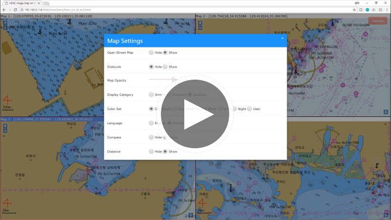
 Open Layers 연동
